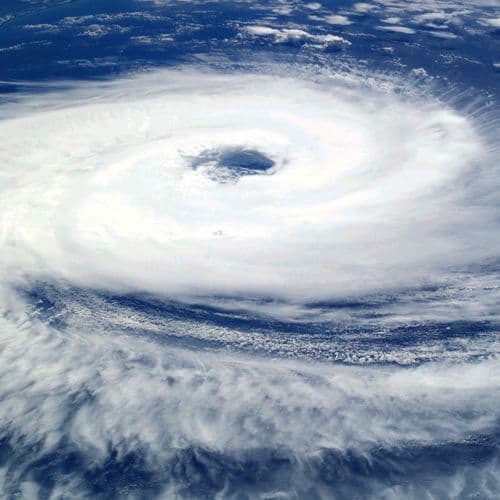
US hurricane center says 80% chance of cyclone in next 48 hours near Florida
Forecasters say the system has an 80% chance of becoming a named storm within 48 hours and could bring 2 to 4 inches of rain.
- On Sunday, July 19, 2026, the National Hurricane Center upgraded a Gulf system to Tropical Depression Two, which has an 80% chance of strengthening into Tropical Storm Bertha over the next 48 hours and seven days.
- Exceptionally warm Gulf waters in the middle to upper 80s F and weakening wind shear are fueling the system's organization, marking a shift toward a more active phase after the Atlantic basin remained quiet for much of the past month.
- An Air Force Reserve Hurricane Hunter aircraft is scheduled to investigate the disturbance Sunday afternoon to gather atmospheric data, while forecasters warn of heavy rainfall, localized flooding, and 1-3 feet of storm surge along Florida's Big Bend through Thursday.
- Tropical Storm Watches are in effect for the Florida Panhandle, as officials urge residents across the northern Gulf Coast, including Alabama, Mississippi, and Louisiana, to monitor the system's progress closely.
- Most forecast models suggest the system will drift westward toward Louisiana by midweek, though meteorologists emphasize that significant uncertainty regarding the storm's final track and intensity remains higher than normal.
109 Articles
109 Articles


Tropical Depression Two advances in the Gulf of Mexico and with the possibility of becoming a tropical storm near the U.S. coast.

Tropical Depression Two is expected to strengthen into Tropical Storm Bertha soon and move along the northern Gulf Coast of Mexico in the coming days.

Tropical Depression 2 forms in the Gulf, the Florida Panhandle is under a Tropical Storm Watch
FPREN | By Irene Sans On Sunday morning, the National Hurricane Center officially designated Invest 91L as Tropical Depression Two. The system has shown signs of better organization over the past 24 hours, with increased convection and a better-defined center of circulation. It is barely moving at 2 mph toward the north-northwest. Maximum sustained winds are 30 mph, and the system is expected to gradually intensify over the next few days. The ke…


Tropical Depression #2 tracks west as storms linger across Central Florida. Here’s what to expect this week.
Tropical Depression Two continues to organize over the northern Gulf. Although it will stay well west of Florida, it will still help fuel scattered showers and storms across Central Florida through Monday afternoon.
Coverage Details
Bias Distribution
- 78% of the sources are Center


![[your]NEWS](/_next/image?url=https%3A%2F%2Fgroundnews.b-cdn.net%2Finterests%2Ffb6dc495f74049f513563c33352175eaa0ecd509.jpg%3Fwidth%3D60&w=128&q=75)


Factuality
To view factuality data please Upgrade to Premium