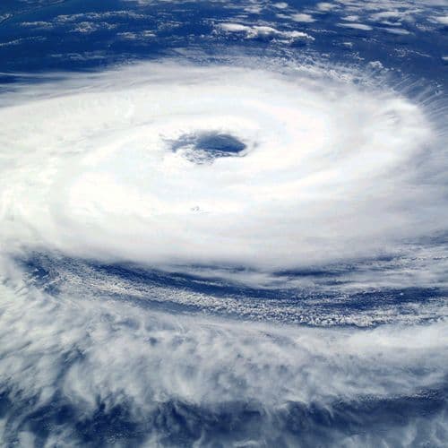
How Will the Circulation of Super Typhoon Champi, Spanning Hundreds of Kilometers, Affect the South China Sea?
 This story is only covered by news sources that have yet to be evaluated by the independent media monitoring agencies we use to assess the quality and reliability of news outlets on our platform. Learn more here.
4 Articles
4 Articles

Due to the influence of Super Typhoon Champi's circulation, the northern part of the South China Sea is experiencing strong winds, waves up to 5 meters high, and rough seas lasting until October 24th, with a potential risk of tornadoes. Super Typhoon Champi, a Category 16 storm, is heading towards Taiwan and is unlikely to enter the South China Sea. Domestic gold prices continue their downward trend, trading at 142.3 million VND. Sudan: Casualti…

(Dan Tri Newspaper) - Super Typhoon Champi has strengthened to level 17, with gusts exceeding level 17, making it the strongest typhoon in the Northwest Pacific region in 2026. Although it will not enter the South China Sea, the typhoon is predicted to cause strong winds in that area.

Due to the influence of Super Typhoon Champi, from October 21st, strong winds gradually increased to level 6 in the northeastern South China Sea, then to levels 6-7, with gusts up to levels 9-10, and sea waves reaching 3-5 meters in height.

The forecast indicates that Super Typhoon Champi is unlikely to enter the South China Sea, but it will cause strong winds and high waves in the northern part of the South China Sea.
Coverage Details
Bias Distribution
- There is no tracked Bias information for the sources covering this story.


Factuality
To view factuality data please Upgrade to Premium