Published • loading... • Updated
Could the Earliest Weakening of the Polar Vortex on Record Bring UK Snow?
Forecasters say the early weakening could shift the jet stream and raise the chance of colder, drier weather in northern Europe, including the UK.
- On Friday, The Met Office warned that a highly unusual disruption of the stratospheric polar vortex is underway, marking the earliest such event on record and threatening to bring icy weather to Britain.
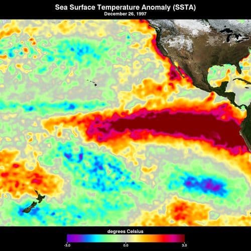
- Jeff Knight, lead climate scientist from The Met Office, suggested the current record El Niño could have 'helped load the dice for this SSW event,' as planetary waves push the vortex out of position.
- Dr. Simon Lee, lecturer in atmospheric sciences at the University of St Andrews, explained the jet stream typically shifts south towards Spain and Portugal, which could increase the risk of snow in Britain.
- Professor Andrew Perez-Charlton of the University of Reading said the 'concerning thing would be if this event ends up bringing the typical drier weather pattern and lack of rain,' potentially preventing reservoir recharge.
- Predicting impacts remains difficult as the Arctic has not yet reached its coldest point; Met Office forecasts suggest the UK may see a stormy start to winter, with colder conditions possible later.
Insights by Ground AI
11 Articles
11 Articles

How Could The Polar Vortex's Early 'Weakening' Impact UK Winter?
The North Pole’s polar vortex, which starts in winter, had a stronger-than-usual start this year.You might think this more intense weather would leave us colder and snowier than usual.But nope – these incredibly strong winds, which circle high above the Arctic, actually help to trap freezing temps, preventing them from spilling south towards places like Canada, North America, Northern Europe, and, as an extension, the UK.However, some forecasts …
·United Kingdom
Read Full Article


Coverage Details
Total News Sources11
Leaning Left2Leaning Right2Center4Last UpdatedBias Distribution50% Center
Bias Distribution
- 50% of the sources are Center
50% Center
L 25%
C 50%
R 25%


Factuality
To view factuality data please Upgrade to Premium