Published • loading... • Updated
El Niño's Storm-Killer Winds and Climate's Warming Waters in Fight over Future of Hurricane Isaias
Forecasters said the storm could bring hurricane-force winds and flash flooding after the Atlantic season’s longest stretch without a hurricane.
- Hurricane Isaias surged toward the U.S. Gulf Coast on Thursday, threatening the region from Mississippi to the Florida Panhandle with landfall expected late Friday or early Saturday.
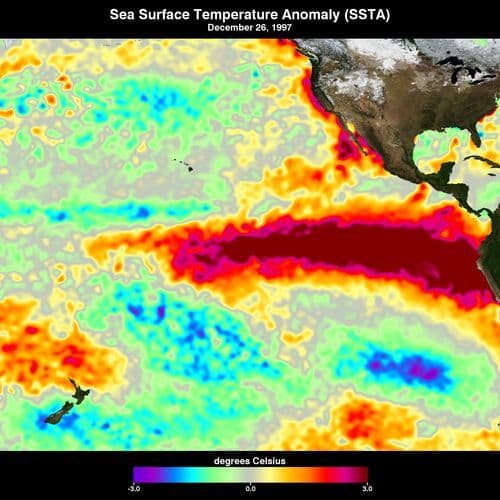
- El Niño dominated the Atlantic hurricane season, keeping it record-quiet until Isaias became the first hurricane to form this year; Colorado State University hurricane expert Phil Klotzbach said the phenomenon "still is certainly driving the bus."
- Warm Gulf Coast waters act as "rocket fuel" for the storm, Klotzbach said, competing with wind shear that previously kept Atlantic storms lopsided and prevented formation of a circular eyewall.
- The National Hurricane Center warned of "life-threatening" storm surge, with flash flood risks extending to Memphis, Tennessee, as the storm arrives as a strong Category 1 or weak Category 2 hurricane.
- Climate scientist Kristina Dahl of Climate Central noted that sea level rise over the past 100 years deepens storm surge, and climate change makes these warm water conditions 100 to 500 times more likely.
Insights by Ground AI
16 Articles
16 Articles
 The Toronto Star
+4 Reposted by 4 other sources


El Niño’s storm-killer winds and climate’s warming waters in fight over future of Hurricane Isaias
A supersized El Niño’s decapitating winds and the Gulf of Mexico’s toasty, storm-fueling waters are battling over the future strength of Hurricane Isaias. And the storm’s tilt and eye show who’s winning.
·Toronto, Canada
Read Full Article


El Niño's storm-killer winds and climate's warming waters in fight over future of Hurricane Isaias
A supersized El Niño’s decapitating winds and the Gulf of Mexico’s hot storm-fueling waters are battling for the core and future of land-approaching Hurricane Isaias and the storm’s tilt and eye show who’s winning
·New York, United States
Read Full Article
Coverage Details
Total News Sources16
Leaning Left9Leaning Right1Center5Last UpdatedBias Distribution60% Left
Bias Distribution
- 60% of the sources lean Left
60% Left
L 60%
C 33%


Factuality
To view factuality data please Upgrade to Premium