State Department Map Mislabels African Countries at Rio AIDS Conference
Rio de Janeiro, Brazil
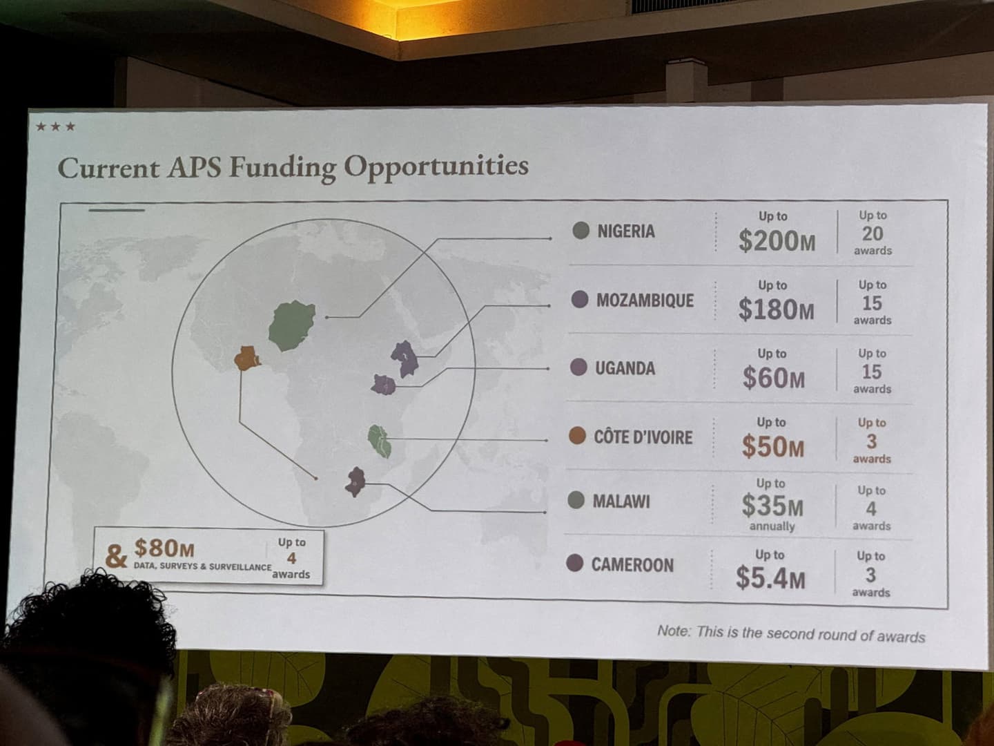
Picture obtained by REUTERS/Reuters
Source Analysis



What Happened
What Happened
Timeline
July 30, 2026
State Department Accepts Responsibility: The State Department acknowledged the error, saying the incorrect map was added after a last-minute change, apologised for the misrepresentation to African delegates, and insisted conference discussions remained productive while reaffirming its commitment to combating HIV/AIDS; the presentation was delivered by Jeff Graham, the senior U.S. official overseeing PEPFAR.
July 30, 2026
Screenshots and Online Backlash: Attendees took screenshots of the inaccurate map that quickly spread on social media; an AIDS expert, Emily Bass, first highlighted screenshots and related posts on LinkedIn attracted tens of thousands of views, drawing sharp online criticism.
July 30, 2026
Major Geographical Errors Noted: The map contained striking inaccuracies: Nigeria was depicted as a landlocked country in the Sahara, Mozambique was moved to the Horn of Africa, and Ivory Coast appeared on the opposite side of the continent.
Summaries by Ground AI
Sources
See All 134Most Written About
The stories getting the most coverage from the last 24 hours




Source Analysis
Timeline
July 30, 2026
State Department Accepts Responsibility: The State Department acknowledged the error, saying the incorrect map was added after a last-minute change, apologised for the misrepresentation to African delegates, and insisted conference discussions remained productive while reaffirming its commitment to combating HIV/AIDS; the presentation was delivered by Jeff Graham, the senior U.S. official overseeing PEPFAR.
July 30, 2026
Screenshots and Online Backlash: Attendees took screenshots of the inaccurate map that quickly spread on social media; an AIDS expert, Emily Bass, first highlighted screenshots and related posts on LinkedIn attracted tens of thousands of views, drawing sharp online criticism.
July 30, 2026
Major Geographical Errors Noted: The map contained striking inaccuracies: Nigeria was depicted as a landlocked country in the Sahara, Mozambique was moved to the Horn of Africa, and Ivory Coast appeared on the opposite side of the continent.


