Published • loading... • Updated
Suriname’s Saamaka tribe turns to mapping and documenting in effort to protect the Amazon rainforest
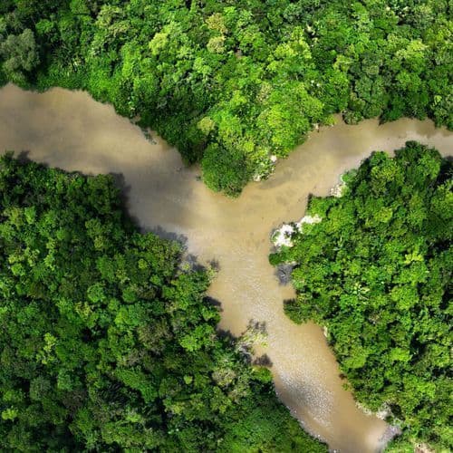
Communities are combining ancestral knowledge with satellite images and GPS maps to document incursions and press Suriname for land-rights recognition.
- Saamaka communities in Suriname are using satellite imagery, GPS mapping, and forest patrols to document illegal logging and gold mining, seeking formal government recognition of their traditional forest management system.
- Descended from Africans who escaped Dutch slavery in the 17th and 18th centuries, the Saamaka maintain autonomous settlements within Suriname's rainforest, where woodcarving remains central to their cultural identity.
- Expanding gold mining and logging, including the 253-kilometer Palmera road, are driving younger men away from traditional crafts toward industrial work offering greater economic opportunities.
- Woodcarver Alingo Doekoe warns mining damage is irreversible, destroying forest conditions; one miner who lost an arm in 2016 returned to the work, citing few economic alternatives.
- While Suriname pledged to protect 90% of its forests, a 2007 Inter-American Court of Human Rights ruling granting the Saamaka collective land rights remains largely unimplemented, limiting their legal authority.
Insights by Ground AI
22 Articles
22 Articles
 union-bulletin.com
Reposted by  Independent Español
PIKI SEEI, Suriname (AP) — Standing on a huge block of wood, 63-year-old Alingo Doekoe bowed and softened a traditional bill, chiseling skillfully wood chips. Little by little, it was taking shape a board for...
 Associated Press News
+16 Reposted by 16 other sources


Suriname’s Saamaka tribe turns to mapping and documenting in effort to protect the Amazon rainforest
The Saamaka people in Suriname are using modern technology to map their ancestral lands. They hope to get government recognition and protection against illegal logging and mining.
·New York, United States
Read Full Article The Daily Advance
+2 Reposted by 2 other sources


In Suriname's rainforest, Saamaka woodcarvers face the pull of gold mining and logging
In Suriname, the Saamaka people are striving to preserve their traditional woodcarving art, known as tembe. This craft, passed down through generations, is integral to their cultural identity. However, expanding gold mining and logging are drawing men away from villages…
Coverage Details
Total News Sources22
Leaning Left10Leaning Right0Center11Last UpdatedBias Distribution52% Center
Bias Distribution
- 52% of the sources are Center
52% Center
L 48%
C 52%


Factuality
To view factuality data please Upgrade to Premium