Published • loading... • Updated
Maps, Video Show Scale of Devastation in Nepal and China After Floods, Landslides
Rescue crews are racing to contain overflow from newly formed lakes as officials warn of more flooding and landslides, with 90,000 people affected, the Red Cross said.
- Catastrophic flash floods and landslides have devastated the Nepal-China border since August 26, killing at least 538 people and leaving around 2,500 missing, CNN reported.
- According to Red Cross estimates, more than 90,000 people have been directly affected by the disaster, with authorities warning that secondary flood risks remain high following the August 26 event.
- In Nuwakot, one of the worst-affected areas, houses and bridges were destroyed, while rescue efforts along the Trishuli River in Nepal were disrupted after the landslide created two new lakes.
- One of the newly-formed lakes began overflowing Friday, according to Chinese state broadcaster CCTV, posing a continuing risk of further landslides or flash flooding for the region.
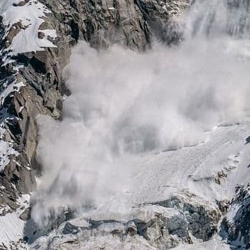
- Authorities maintain particular concern about a barrier lake near the Langtang Lirung peak, as video footage and satellite imagery show the immense scale of the disaster in areas hit hardest.
Insights by Ground AI
19 Articles
19 Articles

After the flood, many journalists travelled to Nepal. However, from Tibet controlled by China, only sparse information is available about Chinese state media. By E. Lamby-Schmitt, ARD Shanghai.
·Hamburg, Germany
Read Full Article
'I was sure I was going to die': After floods in Nepal and Tibet, stunned survivors and desperate families searching for missing loved ones
Hospitals in Kathmandu are seeing a constant stream of people searching for missing loved ones after the massive floods that killed at least 584 people, while nearly 2,500 remain missing in Nepal and Tibet.
·Paris, France
Read Full Article
Why China's censors are scrubbing videos of the Nepal-Tibet floods
After horrifying video of a landslide hitting China-controlled Tibet emerged online it started to disappear in China. This is just one way Beijing is trying to control information about the disaster.
·Ultimo, Australia
Read Full Article


Coverage Details
Total News Sources19
Leaning Left5Leaning Right0Center10Last UpdatedBias Distribution67% Center
Bias Distribution
- 67% of the sources are Center
67% Center
L 33%
C 67%


Factuality
To view factuality data please Upgrade to Premium