International Team Begins Drilling at Durupinar Formation Near Mount Ararat
Turkey
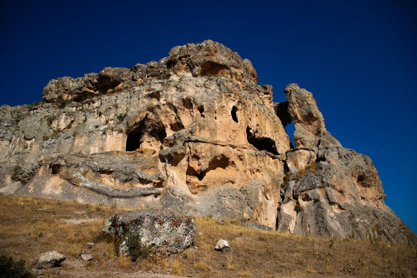
Muhammed Şahin/Pexels
Source Analysis




What Happened
What Happened
Where Sources Agree
- arrows_inputDrilling Operations Initiation: Multiple sources report that an international team has initiated core drilling at the Durupinar formation in eastern Turkey to investigate the site's geological structure, with the project authorized by Turkish authorities and conducted in collaboration with Sivas Cumhuriyet University, according to project updates and university reports.
- arrows_inputDeployment of Exploration Robot: Some sources suggest researchers are deploying Gopher, a robot repurposed from wildlife burrow exploration, into narrow boreholes to capture high-resolution imagery beneath the Durupinar formation, according to project technical documentation.
- arrows_inputExpedition Rhetoric and Goals: Multiple accounts detail that the expedition, featuring marketing director Lauren Witzke, aims to dismantle Darwinism and rewrite university curricula, according to project communications and social media updates.
Where Sources Disagree
- arrows_outputDurupinar Formation Classification: Expedition researchers claim recent drilling and radar data confirm the Durupinar formation is a man-made structure, potentially Noah's Ark. However, geological experts maintain the site is a natural rock formation shaped by erosion, noting a lack of independently verified archaeological evidence to support the vessel theory.
- arrows_outputInterpreting Radar Anomalies: Expedition researchers interpret radar scans as evidence of man-made corridors and chambers beneath the Durupinar formation. However, geologists and skeptics contend these features represent natural geological boundaries resulting from erosion and volcanic activity.
Timeline
January 1, 2027 Upcoming
Samples Sent for Lab Testing, 2027 Plans: The expedition sent physical samples to laboratories for analysis and indicated radar processing and soil results will inform a public scientific statement after lab work is complete, with additional field seasons and further study planned for 2027. Researchers emphasized that laboratory verification and peer review are still needed before any definitive claims can be made.
September 21, 2026
2026 International Expedition Begins Drilling: In September 2026 an international, permitted scientific expedition led by Prof. Cenker Atila began core drilling inside and outside the Durupinar outline, recovering cores to depths of up to about 18 meters and collecting roughly 1,000 soil samples from 150 locations; drilling encountered rich organic layers and an exceptionally hard layer ~4–5 meters down that broke a drill bit. The team also prepared to insert the Gopher underground robot into mapped voids and tunnels to obtain video and samples.
January 1, 2019
Modern Radar Surveys Detect Anomalies: Radar surveys prior to 2026 (including surveys reported in 2019 and later) detected linear and angular anomalies interpreted by the team as possible corridors, chambers and corridors beneath the surface, motivating a deeper physical investigation. The radar results suggested features that could not be resolved without core sampling and targeted interior imaging.
Perspectives and Debates
Summary by Ground AI
Sources
See All 102A varied selection of sources chosen by Ground to reflect the diversity of this story’s coverage.
Most Written About
The stories getting the most coverage from the last 24 hours


Source Analysis
Timeline
January 1, 2027 Upcoming
Samples Sent for Lab Testing, 2027 Plans: The expedition sent physical samples to laboratories for analysis and indicated radar processing and soil results will inform a public scientific statement after lab work is complete, with additional field seasons and further study planned for 2027. Researchers emphasized that laboratory verification and peer review are still needed before any definitive claims can be made.
September 21, 2026
2026 International Expedition Begins Drilling: In September 2026 an international, permitted scientific expedition led by Prof. Cenker Atila began core drilling inside and outside the Durupinar outline, recovering cores to depths of up to about 18 meters and collecting roughly 1,000 soil samples from 150 locations; drilling encountered rich organic layers and an exceptionally hard layer ~4–5 meters down that broke a drill bit. The team also prepared to insert the Gopher underground robot into mapped voids and tunnels to obtain video and samples.
January 1, 2019
Modern Radar Surveys Detect Anomalies: Radar surveys prior to 2026 (including surveys reported in 2019 and later) detected linear and angular anomalies interpreted by the team as possible corridors, chambers and corridors beneath the surface, motivating a deeper physical investigation. The radar results suggested features that could not be resolved without core sampling and targeted interior imaging.


