Published • loading... • Updated
Rains ease but storm surge heads for southwest B.C., posing new flood risk
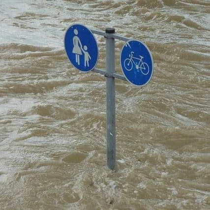
Storm surge could push water levels above predicted tides, with peak flooding risk expected from 10 a.m. to noon, Environment and Climate Change Canada said.
- On Nov. 13, 2026, Environment and Climate Change Canada issued a coastal flooding statement for Metro Vancouver and Greater Victoria, warning that Pacific low-pressure systems and high tides will push water levels past astronomical predictions.
- These warnings follow a deluge where storms dumped more than 300 millimetres of rain on parts of southwestern British Columbia over 48 hours, prompting several evacuation orders and alerts across the region.
- Elevated water levels surpassing tidal predictions will be driven by high winds and "enhanced wave activity," according to ECCC, with peak levels expected between 10 a.m. and noon.
- Shelter-in-Place advisories remain in effect for residents north of the District of Squamish and the village of Pemberton as flooding threatens local properties and infrastructure.
- The seven-day forecast from ECCC indicates little relief, with Vancouver residents facing a continued chance of rain, showers, or cloudy days throughout the coming week.
Insights by Ground AI
40 Articles
40 Articles

A coastal submersion bulletin is in effect in the southwestern part of the province.
·Montreal, Canada
Read Full Article


 Winnipeg Free Press
+31 Reposted by 31 other sources


Rains ease but storm surge heads for southwest B.C., posing new flood risk
VANCOUVER - Deluged residents of coastal British Columbia face a new flooding risk as rains ease, with warnings of a storm surge that could raise sea levels.
·Winnipeg, Canada
Read Full Article
Coverage Details
Total News Sources40
Leaning Left28Leaning Right0Center10Last UpdatedBias Distribution74% Left
Bias Distribution
- 74% of the sources lean Left
74% Left
L 74%
C 26%


Factuality
To view factuality data please Upgrade to Premium